Groundwater and rock are intensively exploited in the world. Given the population density and environmental pressures, quarry lateral extension may be limited. Hence the only solution for the rock operators is to excavate deeper as long as the deposit structure makes it possible. Consequently the water table of the geological formation exploited might be reached when the quarry is deepened. A dewatering system is therefore installed so the quarry activities can continue, possibly impacting the nearby water catchments.
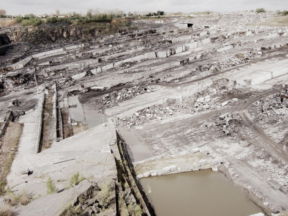
The Neufvilles quarry site (Walloon Region, Belgium). The quarry has a maximal dewatering flow of 2.000.000m3 per year. The water table dropped from an initial altitude of 70m down to currently 25m. Picture courtesy of Louise Collier.
We propose two interaction indices between extractive activity and groundwater resources based on six parameters used in the assessment of natural hazards. These parameters are grouped in two distinct categories:
- the geological, hydrogeological and piezometric contexts defining the hazard that a quarry represents;
- the relative position of the quarry and the water catchments, the production of the catchments and the potential quality of the groundwater characterising the vulnerability of the groundwater resources.
Depending on the value of the interaction index, the quarry will present a low, a medium, a high, or a very high potential impact on the regional hydrogeology. Hence it determines the recommended level of investigation of the feasibility study to undertake before considering any extension of the quarry.
| Interaction Index | Feasibility study |
| low | hydrogeology characterization |
| medium | low + piezometric monitoring |
| high | medium + steady state (static) mathematical model |
| very high | high + transient state (dynamic) mathematical model |
The first index is based on a discrete choice modelling methodology while the second is relying on an artificial neural network. These two complementary approaches (the former being probabilistic while the latter fully deterministic) are able to produce accurate results and have been successfully applied on the Boverie quarry and the Tridaine gallery located in Belgium.
Great to see SMART developing research on groundwater and extraction industries!